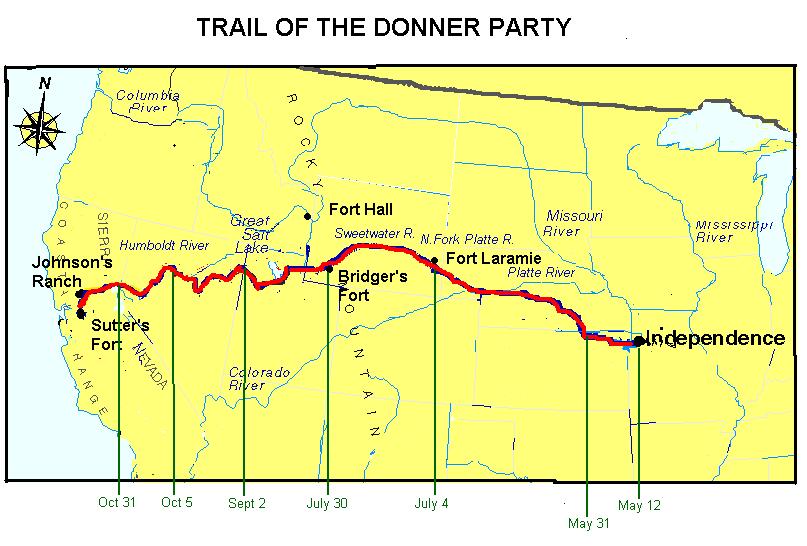
Maps of the Donner party
James Reed’s Map of the Humboldt River and Sierra Nevada

Routes of the Snowshoe party and Relief parties
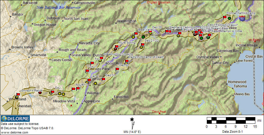
Locations of Camps and Trails
Map drawn by William Graves for C.F. McGlashan, 1879
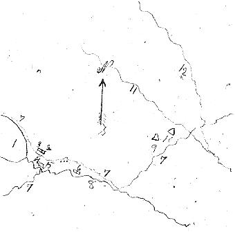
- Truckee's (now Donner) Lake
- Schallenberger's Cabin - Breens (site of present Donner Monument)
- Keseberg's Addition to Schallenberger Cabin
- Big Rock (in Donner Memorial park)
- Cabin built against Big Rock - Murphys and Eddys
- Graves’ Cabin, with Addition for Reeds, Stanton, Luis and Salvadore (on Donner Creek north of present Interstate 80 Agricultural Inspection Station)
- Roads (present Hwy 89 from Alder Creek to Truckee, old Hwy 40 from Truckee to summit via north shore of Lake, and trail up Coldstream Canyon south of Lake)
- Branch of Truckee's River (now Donner Creek)
- Donner Tent
- Donner Tent (It is not known exactly where these tents were, but Mrs. Wolfinger stayed with the George Donners, and the teamsters apparently built another tent nearby.
- (now Alder) Creek
- (now Prosser) Creek
Camps and trails shown with present roads
Trail location based on Graydon’s Trail of the First Wagons Over the Sierra Nevada

For further details, including how to locate the Trail today, see the books listed in the bibliography of Donner sources.